BACKGROUND
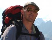
Chris Hopkinson is the Campus Alberta Innovates Program (CAIP) Research Chair in Terrestrial Ecosystems Remote Sensing. He was appointed to this position in 2013 after spending a year as a visiting environmental scientist with the Commonwealth Scientific and Industrial Research Organisation (CSIRO) in Canberra, Australia. Prior to this he led the airborne lidar research and outreach activities of the Canadian Consortium for Lidar Environmental Applications Research (C-CLEAR) while employed as a research scientist and lecturer at the Applied Geomatics Research Group in Nova Scotia.
Check out this recent article: A recent 3D Visualization World interview
RESEARCH INTERESTS
With a background in engineering and geography, Chris' earliest and still active research interests are mountain hydrology and water resources. After spending time in the private sector as a lidar specialist and field manager and then as a postdoctoral fellow in the remote sensing of forest resources, his area of research expanded into testing and developing lidar mapping and imaging technology applications across a range of geosciences themes. From 1999 to the present, he has maintained an active connection to the development and operation of lidar technologies and this has provided unique insights into their suitability, limitations and appropriate use (or misuse) for natural resources and environmental assessment applications. In addition to conducting procedural and algorithm research, Chris has been active in providing guidance on the development of best practices for various government agencies as well as serving on a number of executive committees in Canada and the US.
Recently, his research has focussed more on integration of in situ, high-resolution remote sensing, spatial and temporal data sources to better understand such processes as glacial and periglacial dynamics in alpine environments to novel carbon balance assessment routines in forest environments.
CURRENT RESEARCH
Integration of thermal and lidar imaging to produce 3D thermal sequences of environmental phenomena. This research has technical elements requiring the development of sensor hardware integration, programming and post processing routines, as well as physical science elements in terms of supporting the extrapolation and modeling of field based ground surface energy balance at a number of study sites.
Due to a large network of collaborators in Canada and around the world, Chris is actively supporting or collaborating on a range of projects utilising airborne, satellite or terrestrial lidar to support algorithm development, forest attribute modeling, carbon balance assessment, radiative transfer, cold regions climate change impacts, landsurface classifications and uncertainty propagation modeling. An area of planned research emphasis in coming years is in the development of efficient and consistent lidar-based data fusion and integrated geosciences application workflows.


